
In 1850, Samuel and Jacob Rickner were living in Jasper County, Missouri in the southwest corner of the state, along the border of the Indian Territory that would become the Kansas Territory in 1854 and the state of Kansas in 1861.
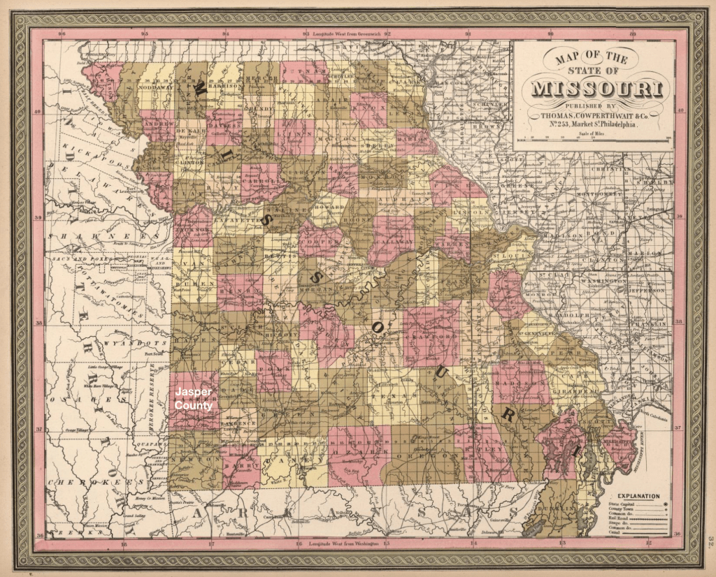
Samuel was working the land as a farmer. His real estate was valued at $700 in the 1850 US Federal Census. He was living with his first wife, Permelia Baker, a widow with two older children, James and Nathan Cook, and their eight children. Enumerated after Samuel was his brother Jacob, a game hunter with a wife and children.
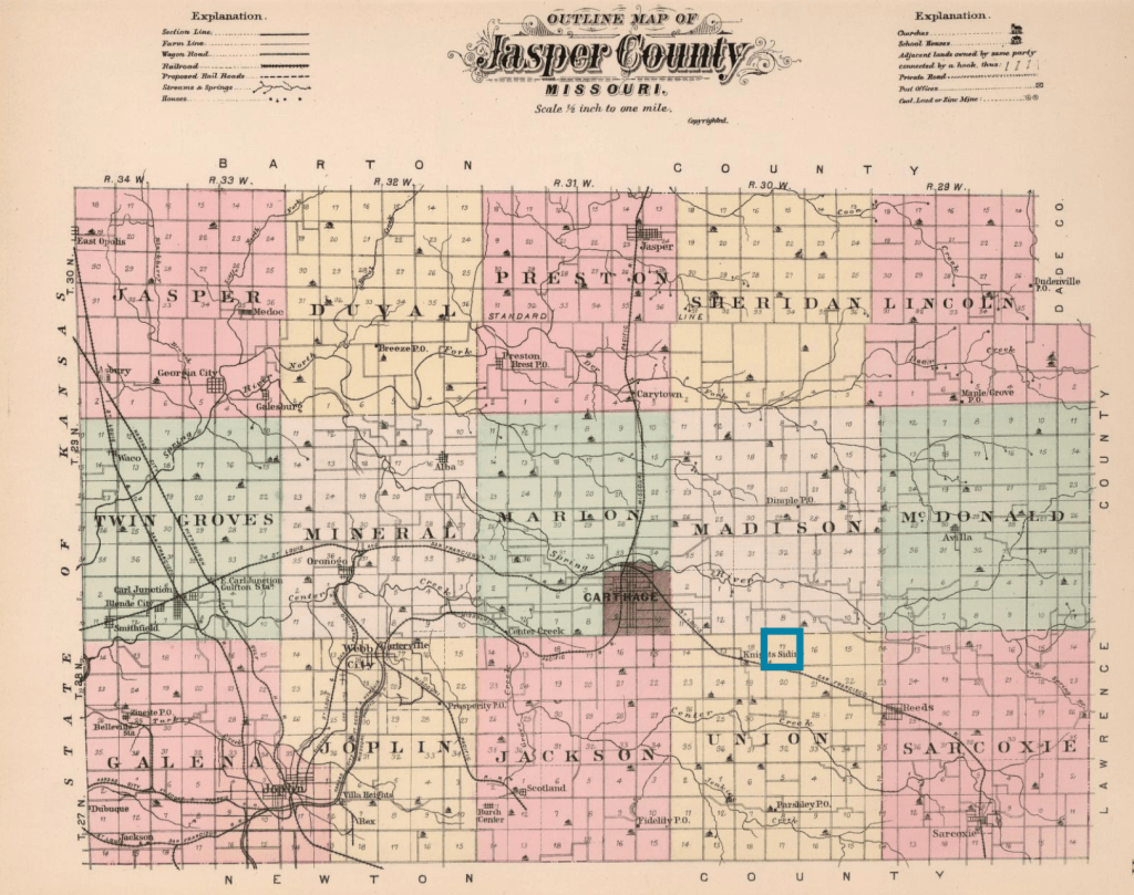
Land records (blm.glorecords.gov) show Samuel Rickner owned land east of Carthage in T 28 N and R 30 W, section 17. He purchased two parcels in 1844 and another parcel in 1852 and 1853, all in the same section. He also purchased parcels in section 9 and section 20, adjacent to section 17 to the northeast and south respectively, expanding his property beyond the original $700 value.
By 1857, Permelia had died, and Samuel remarried. In November 1857, the Justice of the Peace for Sarcoxie Township in Jasper County, Missouri “solemnize[d] the rite of matrimony between Samuel Rickner and Margaret E Reneau.
By 1860, Rickner has moved his family west, across the border, into the Kansas Territory. He is living in what was then called McGhee County in the Kansas Territory, near the post office of Crawford Seminary. Crawford Seminary was a post office on the mail route from Fort Scott and a mission for the Quawpaw Indian tribe.
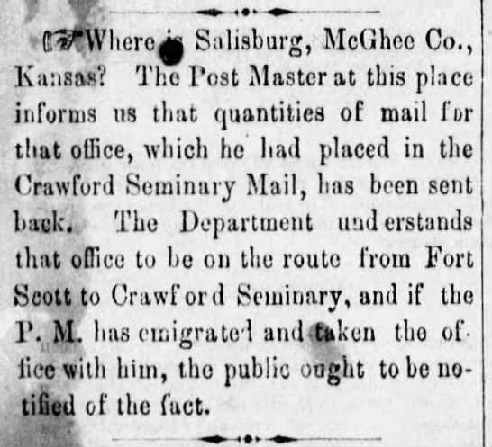
Crawford Seminary had been established in the 1840s by a Methodist minister from Sarcoxie, Missouri, originally on Spring Creek in Jasper County. Five years later, they moved the seminary onto the military road from Fort Smith (Arkansas) and Fort Leavenworth (Northern Kansas), within Kansas Territory. It was closed when there was a measles outbreak in 1852. The purpose of the missionary was to convert the American Indians, specifically the Quapaw tribe.
The US Federal Government had forced the Quapaw tribes (connected to the Siouan family of tribes) to the Indian territory in 1834. French-speaking colonists had learned the Algonquian name for the tribe “akansa” and assimilated that into French to be Arcansas, which became the name for the Arkansas river and state.
The map shows the geographical relationship between Fort Scott, the Quapaw Reservation, Shoal Creek, Jasper and Newton County.

In 1945, the Joplin Globe ran an obituary of Sarah Jane Gaither, the daughter of Samuel Rickner. It shares that she was born in 1844 near Willow Springs, five miles east of Carthage and that her father also homesteaded a farm on Shoal Creek, southwest of Galena [Kansas].
The biography of Christopher Rickner (Samuel’s oldest son) records that Rickner “came to Kansas when it was still a territory” and lived there until his death in 1861. The government began to sell the land in the 1850s to white settlers, and the while there had been earlier attempts by Euro-Americans to settle the land, the first white settlers came in 1856.
His son appears to have settled on that homestead near the Crawford Seminary Post office. The biography records that Christopher Rickner came to Cherokee County [McGhee Territory] in 1861 and settled in Garden Township, Cherokee County; he soon left for Missouri for five years and returned in 1866 where he stayed. He received his land from the government in 1870 in Cherokee County.
The excerpt from the 1902 Plat Book from Cherokee County shows the relationship between Rickner’s farm, Shoal Creek and Galena. The eastern edge of the excerpt is the state border between Kansas and Missouri.

Sources
Johnson, L. G., Johnson, L. G. (2009). Tar Creek: A History of the Quapaw Indians, the World’s Largest Lead and Zinc Discovery, and the Tar Creek Superfund Site. United Kingdom: Tate Publishing & Enterprises, LLC.
History of Cherokee County, Kansas and Representative Citizens. (1904). United States: Biographical Publishing Company.
“Cherokee County” on Community & Conflict, the Impact of the Civil War in the Ozarks. access from ozarkscivilwar.org

Impressive, as always.
LikeLike